Sunday, November 7, 2010

San Antonio PacMan

Jason, Brian, Andy and Sarah, and myself did a route around and up San Antonio Mountain. We had driven by this peak dozens of times on our way to Colorado, so today was the day to climb it. The route was almost all cross country (except about 2.5 miles of dirt road) and we got great views in all directions. The top of the mountain is covered in pine and aspen forest and would be great to see when the aspen leaves are changing. The name "PacMan" comes from Jason's proposed route, which looked like a PacMan: http://bit.ly/SanAntonioRun

The route we ended up taking was not too far off:


Overall we got in around 17.5 miles with around 4,000 feet of climbing.
Photos:
http://picasaweb.google.com/billgeist/SanAntonioPacMan#

Elevation profile:

Saturday, September 11, 2010

New Trails in the Jemez

Went with Jason today to explore some trails that we heard about. We ran up Corral Canyon and found some really nice single track trails to run in. In the winter time, this area is popular with cross country skiing. We got 9 miles in and it was great to explore and run on some new trails (to me). GPS track pictured below. This route had ~1,800 feet of elevation gain and loss.

Friday, September 10, 2010

Cascade Crest 100 Mile Endurance Run

Cascade Crest 100 mile endurance race – 2010

Picasa Photo Album

My quest to run the CC100 started over two years ago. In 2008 I started the race and dropped at the French Cabin Aid Station (mile 88) because of a problem with my knee. The race this year was a totally different story. I had one of my best ultra runs ever. A combination of experience and great conditions enabled me to run faster than my expectations and set a new PR for a 100 mile run by over three hours.

Before describing my experience at this race, I want to list some of the reasons that make this race a worthwhile addition to anyone’s to do list:

10 am start. The “late” start is a great way to do a 100 mile race. Almost everyone doing a 100 mile race will be up through a night, so with the late start, I was able to get a great night rest and have a leisurely morning. Another nice touch is the breakfast that is served in the Easton fire house before the start.

Weather. This year the weather conditions were nearly ideal for running. Highs in the 70s and lows in the 30s with no precipitation. Generally speaking, I think that usually the conditions are nice (with the exception of rain) for this race.

Course. The course featured a one loop course on single track and jeep roads. The majority of the forest service roads were encounter during the night which I think is ideal conditions for running in the dark.

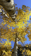
Pacific Crest Trail. The approximately 30 miles of running on the PCT was awesome. This trail is awesome single track through amazing pine forest. The grade is perfect for running and the surface for the most part is smooth and soft. The section by mirror lake is very picturesque.

Ski area and trail for hell. Not the entire course is easy and these sections add a nice balance to the course. The sections down the Snoqualmie Ski Area and the section along Lake Kachess offer up some technical terrain and off trail running that compares well to other popular and tough races across the country. With these sections the race has a bit of everything.

Views. The course goes over and along several ridges which offer up great views of the surrounding area. My only complaint was that Mt. Rainer with covered with clouds, so only the base was visible.

Aid stations and volunteers. Everyone associated with the race was great and there were plenty of aid stations along the course.

Elevations. With 22,000 feet of climbing this race is not easy, but what was nice was the average elevation. Coming from Los Alamos at 7,500 feet, even the high point of the race was at a low elevation for me.

This was one of my best races to date. As I lined up at the starting line, I was not sure how the day would unfold. I was just getting over a cold that I had since the previous week. I made the decision to try and run the first half of the race at an easy pace and so I started out in mid pack. The first 25 miles when by easily. I was taking my time and getting lost of pictures and it was great to be running with my friend, Jason. For the first several miles I felt like my cold was going to slow me down but as I got further into the race it did not seem to be a factor. Going through the pine forests and the awesome trails made the time go by quickly.

About a 1/3 of the way into the race I was feeling good and felt that I could have a good day. So I just kept up the pace and tried to minimize my time at the aid stations. Since I ran the race two years ago, most of the course was familiar to me. I went past Mirror Lake as the sun was setting and got by the Olallie Meadows Aid Station before having to turn on my headlamp. Darkness came as I was making my way up to the top of the ski area. Getting to the top took longer than expected as the course snaked around the mountain. Once at the top, I stopped for a minute and enjoyed the night time view. I could see down to the next aid station from here. The descent was abrupt and straight down a loose ski run. Half way down we took a hard left turn and continued dropping for an eternity. Eventually we traversed right across the mountain and through some residential area to the Hyak Aid Station.

Hyak is the approximate halfway point of the race and I was feeling great. The legs felt good and I was not having any stomach issues. I left the Hyak Aid Station running down the pavement and then continued with a quick climb up Keechelus Ridge on the forest service road. About a mile before the Keechelus Ridge Aid Station I encountered a runner how had gotten lost and was close to hypothermic. After offering some of my clothes, he requested that I go to the next aid station and send help. I pushed the pace up to the aid station to alert them of the runner in distress. From there it is a short climb to the top of the ridge and then a quick run down to the Kachess Lake Aid Station.

Next up was the famed “trail from hell” section of the course. First up was an off trial section to the lake which required lots of climbing over and ducking under trees. One tree was so big that the only way to get over it was to hug it and swing across. There were even the words “hug me” painted on the tree to alert runners to the preferred way around this obstacle. Any mistake here would result in a long slide down into the unknown. After that section the course continues along the lake. This section is slow because of down trees, technical primitive terrain, lack of daylight, and lots of short steep climbs. I kept thinking I was almost to the end only to discover that the lake continued on. Eventually I got through this section and to the last big aid station at Mineral Creek.

I made decent time up to No Name Ridge Aid station and was still feeling great. The section across the ridge was not as bad as I remembered from two years ago and before I knew it I was doing the out and back up Thorp Mountain. Going into the French Cabin Aid Station feeling good was a relief as two years ago I dropped here because my knee had swollen up. Now all I had left was downhill to the finish and it looked like I could do it in less than 25 hours.

I ran hard down this section which was something that I was not accustomed to doing so late in a race. The miles ticked away and then I was dropping down the switchbacks into the final aid station. Quickly filling up my water bottle I was on my way back to the firehouse in Easton. As I ran to the finish line I thought to myself what a great race I had. My stomach did not bother me at all during the race and my legs felt good. This was the first time in a race that I felt like I could actually run the entire race instead of doing the all too familiar “shuffle jog”. I am not sure how to explain it, but I think that with several years of experience combined with good training allowed me to run strong at the end. I finished 20th place with a time of 24:32:27. Now time to start dreaming about the sub 24 hour race……

Thanks to Dylan for his assistance in crewing and to Charlie, the race director, and the rest of the volunteers for holding the race. This is a great race that I highly recommend to others to do.

Sunday, August 15, 2010

Stats for today's run:
29.82 miles
Elevation change ~7,500 feet
Time 7:28

Thursday, June 4, 2009

Running at Sea Level

Today I flew to Columbia, MO for work. I feel so fast running at sea level on flat terrain. After checking into my hotel, I went to run on the MKT Trail. Before I knew it I had run 4 miles and I was not even breathing heavily. My stats for the run today:
Time: 59:44
Distance: 8.2 miles
Average Pace: 7:17 minutes/mile
Average HR: 159 bpm

Also, I had an awesome day on the ski hill on Wednesday after a slow day on Monday.
Wednesday stats:
Lap 1: 18:44 up and 8:30 down
Lap 2: 18:51 up and 9:29 down
Lap 3: 18:43 up and 8:58 down

Monday stats were all over 20 minutes up.

And the most random thing that happened to me today was running into Erik and Lucy at the MKT trail head after my run. Erik and Lucy lived in LA for a while but are currently on a multi year trip around the world climbing. Totally weird to run into them in Columbia, MO.

Sunday, May 31, 2009

Bike Ride from LA to Nambe

Today was a perfect day for a bike ride. I meet up with Tim, Jason, Alan, and Claire for a group ride. We left LA around 9 and headed down to Pojoaque. We had a quick ride to Pojoaque making it there in under an hour. From there we rode into Nambe and went up to Nambe Reservoir. I had not been on this section of road and I enjoyed it, especially on the ride back to Pojoaque. Nice and fast with good pavement. From Pojoaque we worked well as a team and made quick work until the going got tough pedaling up the main hill road. All in all, thing worked out well as we got back into LA just before the afternoon showers started. Should be interesting to see how my legs feel for ski hill repeats tomorrow after a busy weekend.....

Elevation and Speed Profile

Stats from today's ride:
Distance: 61.13 miles
Time: 3:50:01
Stopped time: 22:29
Average speed: 15.9 mph
Moving speed: 17.6 mph
Average HR: 131 beats per minute
Elevation gained and lost: 2,200 feet (seems low, should be more like 3,000 feet)
Average cadence: 72.8

Friday, May 29, 2009

Santa Fe Baldy

Today I did a training run up Santa Fe Baldy with Jason, David, and Tom. The weather was perfect and this was a very enjoyable outing.

Self Portrait on Santa Fe Baldy

Stats from my GPS watch:
Distance: 13.81 miles
Time: 3:29:59
Pace: 15:12 per mile
Elevation climb: 3,453 feet
Calories: 1,593
Average HR: 136 beats per minute

Time to top: 1:58:01
Time on top: 11:49
Time on descent: 1:20:07
Pictures