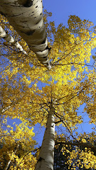
Jason, Brian, Andy and Sarah, and myself did a route around and up San Antonio Mountain. We had driven by this peak dozens of times on our way to Colorado, so today was the day to climb it. The route was almost all cross country (except about 2.5 miles of dirt road) and we got great views in all directions. The top of the mountain is covered in pine and aspen forest and would be great to see when the aspen leaves are changing. The name "PacMan" comes from Jason's proposed route, which looked like a PacMan:
http://bit.ly/SanAntonioRunThe route we ended up taking was not too far off:

Overall we got in around 17.5 miles with around 4,000 feet of climbing.
Photos:
http://picasaweb.google.com/billgeist/SanAntonioPacMan#Elevation profile:


Nice, Bill....thanks for posting!
ReplyDeleteSteve